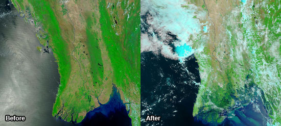
According to a newly released study from the FAO, the Food and Agriculture Organization of the United Nations, the deforestation in Burma have exposed coastal communities and worsen the effects of the cyclone.
Jan Heino, the Assistant Director General of the FAO Forestry Department, said in the report that "mangroves have been converted to agricultural land and fish ponds. Settlements have been established closer to the sea and the combination of proximity to coastal hazards and lack of a protective forest buffer has increased the risks to human populations in many countries."
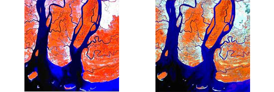
The mangrove area in the Ayeyarwady Delta, who was severely hit by the cyclone, have lost have of its former size since 1975. It is expected that only about 100 000 hectares remains.
The satellite images below shows the depletion of mangroves in the Ayeyarwady Delta, Myanmar between 1995 (left) and 2000 (right). The dark red colour indicates dense mangroves.

According to the NOAA Satelllite and Information Service the sea surface temperatures were over a full degree Celsius above average in the region where Nargis intensified before landfall.
Sunita Narain, director of the Indian environmental group Center for Science and Environment, said that "while we can never pinpoint one disaster as the result of climate change, there is enough scientific evidence that climate change will lead to intensification of tropical cyclones."
Mitch Anderson, from the DeSmogBlog, says that "Nargis is a sign of things to come. The victims of these cyclones are climate change victims and their plight should remind the rich world that it is doing too little to contain its greenhouse gas emissions."

Recommended Comments
Join the conversation
You can post now and register later. If you have an account, sign in now to post with your account.